


Author: zhang xian (deputy researcher, national priority laboratory for remote sensing sciences, institute of space-based innovation, chinese academy of sciences)
Previously, the ground-detection team 01 b was successfully launched. Ab double-star formations will be visible in geological disasters, land surveys, basic mapping, disaster prevention and mitigation. The technology they apply is remote sensing. Today, “remote sensing” is well known — remote sensing, which refers to non-contact, long-range detection techniques, and generally to the detection of the electromagnetic wave radiation and reflective properties of objects through remote sensors, thus using this non-contact mode to sense the characteristics of objects. So, what has happened since the invention of remote sensing? What is the future
Where's remote sensing
High-point one, one shot. 800 kilometers
What we are saying today is that remote sensing generally refers to activities using remote sensors to observe the earth's surface on platforms at a certain distance, such as aircraft, satellites, etc. Of course, the use of wireless sensors to observe the surface, mine detection or other penetrating remote sensing vehicles is also considered to be a broad area of remote sensing。
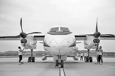
In 2021, the ars system was accepted by the state and allowed for full-time, high-precision earth observation. Xinhua
For the general public, remote sensing, which is the most familiar and first to develop, is the observation of the earth's surface from satellite platforms, one of the fastest-growing fields of science and technology in the late twentieth century。Satellite remote sensingThe surface profile information can be provided on a frequent and sustained basis and is characterized by macro, dynamic and accurate monitoring of surface environmental changes. In general, remote sensing technologies, including satellite remote sensing, have the following advantages:
First, large-scale observations. Remote sensing aircraft fly at an altitude of about 10 kilometres and land observation satellite orbits generally of about 600-800 kilometres. For example, our high-point 1 satellite can cover a wide area of 800 kilometres, roughly the same distance as beijing to anhui north. This perception is the relationship between sight and distance in the eyes of the ancient people who “wanted a thousand miles to go up”。
Second, access to information is fast, short-lived and subject to few ground restrictions. In particular, multiple observations of the same area can be made even within one day through satellite network observations or large wide camera observations. For areas that cannot be reached on the ground due to natural conditions or national borders, access to ground information can also be facilitated and timely through satellite remote sensing。
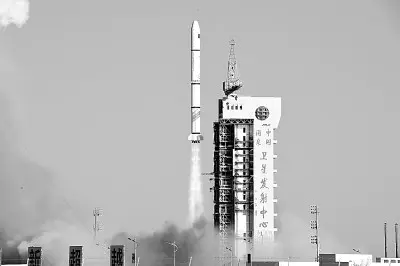
In november 2021, our country successfully launched the 32nd group of remote sensing satellites. Xinhua
Third, there are many means of accessing information and a large amount of information. For different purposes, remote sensors with different bands and modes of detection can be selected for information. For example, information on visible light detection of object surface shapes, colours, etc., can also be obtained through infrared detection of object temperature information, and information on the interior of the feature can be obtained using different permeability in different bands。
Whereas 80 per cent of human information needs are related to geospatial location, remote sensing plays an increasingly important role in the national economy, social development and national defence security in the context of the growing global problem of the resource environment. The nine major areas of remote sensing application identified by the group on earth observations (geo) cover disasters, health, energy, climate, water, weather, ecosystems, agriculture, biodiversity, etc., and, above all, all aspects of human life。
Why quantitative remote sensing
From "seeable" to "yes"
The perception of things is always visible and then material, especially in the case of natural science, observation-summation-summation-integration-factory-factory research logic. Researchers have focused more on mathematically building mapping relationships between the subjects of the natural world in order to interpret natural patterns in mathematical terms and further predict them. Quantification and application are therefore more critical to natural science than qualitative descriptions. The analysis of the natural sciences and the definitive description of pattern phenomena are dependent on the “data” or “quantitative” research base。
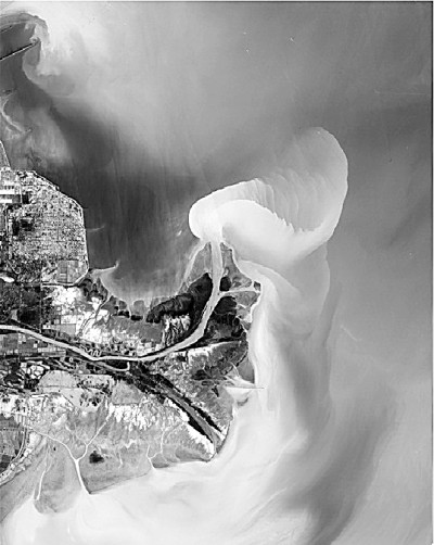
A coloured satellite image of the yellow river into the sea, based on high score 1 data. Information pictures
Since the 1970s, satellite remote sensing has been based mainly on vertical observations to obtain surface two-dimensional information, while the data obtained have been based on the assumption of over-reflection of ground targets, with some simple correction and spectral properties of ground targets used for surface classification or empirical interpretation. Early remote sensing applications are more based on qualitative descriptions, i. E. Extrapolation and application of the properties of features through visual features such as colour, texture, shape, size, etc. However, with the development of demand, qualitative remote sensing has become increasingly difficult to meet in terms of scientific research and applications。
For example, satellite remote sensing, through cloud maps, can provide a very visual picture of the movement trends of various gases, but the accuracy of medium- and long-term weather forecasts remains unsatisfactory. One of the main reasons for this is the need for quantitative information in atmospheric kinetic models on the albedo rates that affect surface and atmospheric temperatures and the roughness that affects current movements. Qualitative analysis clearly does not meet this need。
Naturally, research aimed at obtaining more quantitative information on features by means of remote sensing has begun, and quantitative remote sensing is expected to carry more needs for applications。
So, what is quantitative remote sensing? For qualitative remote sensing, quantitative remote sensing is the means by which the quantification of certain features of a feature is derived from a reflection of the feature or from electromagnetic radiation launched. Generally speaking, it is to link remote sensing information to observations of surface targets, based on the various electromagnetic radiation signals obtained by remote sensing, by means of mathematical or physical models, quantifying or extrapolating the various natural properties of the target。
What are the advantages of quantitative remote sensing? We take the example of global climate change research. Quantitative remote sensing data products play a crucial role in global climate change research. They not only enable the operation, evaluation and validation of numerical process models as input arrays, but also determine certain state variables or parameters of the process models by means of timely input updates combined with data assimilation in order to improve modelling accuracy and forecast, for example, carbon, water, nitrogen fluxes at different spatial scales. In the various operational applications of the industry sector, assessments place greater demands on quantitative indicators and on the quantification of remote sensing。
Quantified remote sensing
Modeling, replaying the parameters is difficult
As noted earlier, quantitative remote sensing is a necessary route to increase the level of remote sensing applications。
However, quantitative remote sensing is difficult to authenticate. Its accuracy depends largely on both forward model construction and parameter inversion。
What's forward modeling? In order to understand this principle, let's begin with a poem in ming dynasty: "the sunset will fly in red." so it was said by li, "why do the poets see the willows red when it is white?" this may be due to three causes: first, the relationship between solar exposure and observations. Due to the sunset, the optical path of solar light through the atmosphere is long and the short-band dispersion is severe, resulting in direct light red. The second reflects the characteristics of the surface parameters: peach blossoms are burned, forming a red substrate that leads to a reflection of red. Again, it reflects the properties of aerosols: the willow itself is a full-wave reflection, at a time when it reflects the sun and the sun, and it reflects the peach red, so the willow becomes a piece of red。
And we build forward models that combine the spectrum of signals, the spatial ranges of the pixels, the imaging time, the angles of solar exposure and observations, the polarization properties, the sets of parameters describing atmospheric and surface characteristics in a mathematical expression to describe the radiation signals received by remote sensing sensors。
Modelling is a prerequisite and basis for quantitative remote sensing in retrospect, while the complexity of remote sensing imaging processes to reach satellite sensors, which cross the atmosphere, vegetation, reach the soil, re-reflect vegetation and the atmosphere, makes it extremely difficult to describe mathematical models。
The inversion process is the reverse process of modelling, i. E. The process of estimating the set of parameters of atmospheric or surface properties by the reverse of the electromagnetic radiation signals observed by remote sensing. Theoretically, quantitative information on surface characteristics of our interest can be obtained through multiple methods of observing equation groups. But “the ideal is full and the reality is so strong that the surface is too complex and remote sensing is always limited - this is akin to the image of the blind, where much of the information is limited and isolated and where accurate knowledge requires integration, accumulation and synthesis of the information obtained. We have been trying to find better solutions to problems, such as the use of a priori knowledge, time and space constraints, multistage inversions, optimizing inversions, etc. I will not dwell on the many professional and mathematical elements involved。
What is our quantitative remote sensing level
Keep up the international lead, and the future will have to refuel
Our quantitative remote sensing research began in the 1990s and has been at the forefront of the international community, driven by leading scientists, such as the li xiaowen academy. With the flourishing of our space industry, the growing demand for remote sensing in the industrial sector and the steady development of disciplines by remote sensing scientists, our country is bound to move steadily from being a major country of quantitative remote sensing to being a powerful country of quantitative remote sensing。
So, how will future chinese quantitative remote sensing be developed? In the view of the author, the following points could be highlighted:
Increased attention was paid to the presentation of our autonomous satellite plan with clear scientific objectives. Currently, national satellites are still increasingly on the road of imitation and running, and there are still significant traces of imitation from satellite observation models, payload settings, payload imaging (observation) systems, etc. Although, for operational satellites, this means more stable, reliable and reusable data. For scientific research, however, this means that there are fewer new types of observations. Satellite programmes such as casearth, high score five (partial payload), carbon satellites, water satellites, etc., which are driven by the users of scientists on specific scientific issues, should be more supported。
At the same time, greater emphasis should be placed on the openness of domestically produced satellite data products to international users. The steady improvement in the quality of the quantitative products of the national satellite data, as a result of concerted efforts such as the development of payloads, ground-based validation and the production of common products from national satellites, has made it all the more necessary to open them to international users, both as an expression of our scientific and technological self-confidence and as a concrete way to increase the international impact of our remote sensing satellite products by attracting more international users to use them。
Moreover, more attention should be paid to the “two ends” of quantitative inversion. The front-line model of surface radiation is the basis for quantitative remote sensing in retrospect, and our scientists are at the forefront of the improvement, integration and application of the front-line model of surface radiation and require a joint effort by researchers in the preparation of forward models for complex scenarios, new imaging systems and new remote sensing models. Quantitative remote sensing inversion products are directly targeted at users of scientists and industry, and, like other marketed products and services, product quality, product usage instructions, technical support to users, product uncertainty and regional applicability need to be synchronized so that users of different categories can gain better user experience。
The day of light (16th edition, 2022, 03/03)


